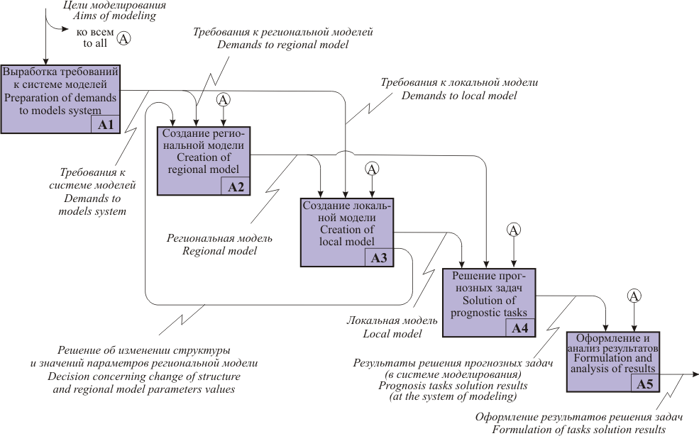
Variously-scaled mathematical models systems creation process is given on the Figure.
Variously-scaled mathematical models system creation
Development of demands for the system of models consists in detailing of aims of investigation, in modeling task definition, in determination of various criteria of solution quality estimation, times of solution of financial, personnel resources and so on. During the process of its performing all present information about hydrogeological object including these storing at bases of graphic and semantic data are used.
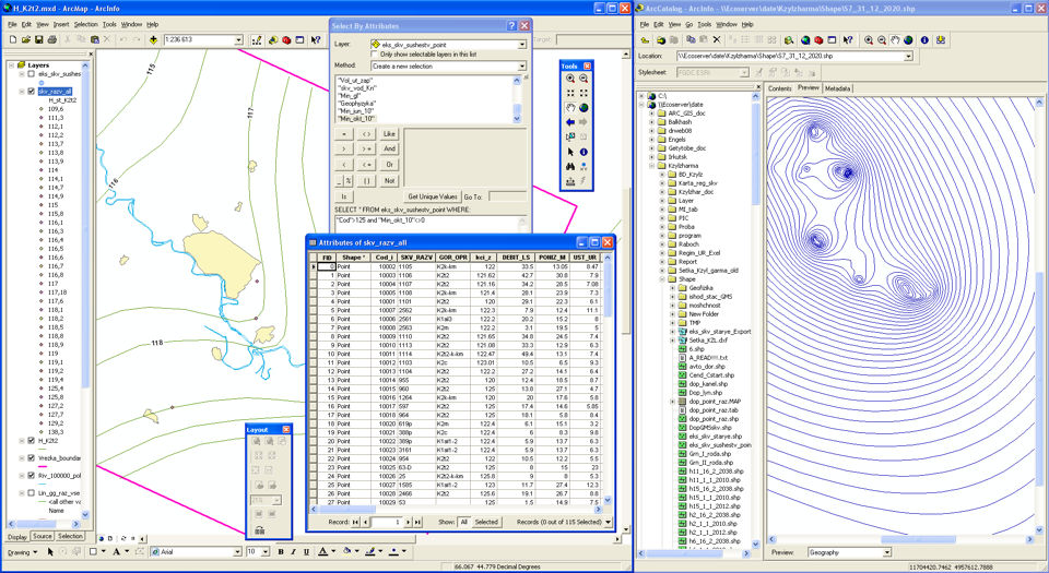
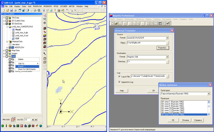
Choice of information from graphic data base with help of ArcGIS 9.3
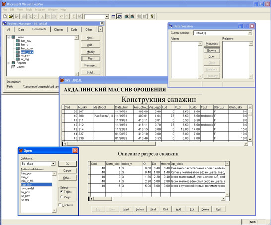
Selection of information from semantic data base with help of DBMS FoxPro 6.0
Stages of creation of regional model are given on the next Figure.
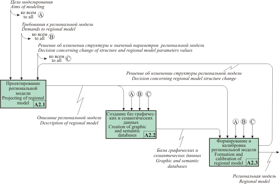
Preparation of the regional model
Detailed description of the regional model creation methods are discussed at the chapter 3.
Local model creation process includes the following basic stages.
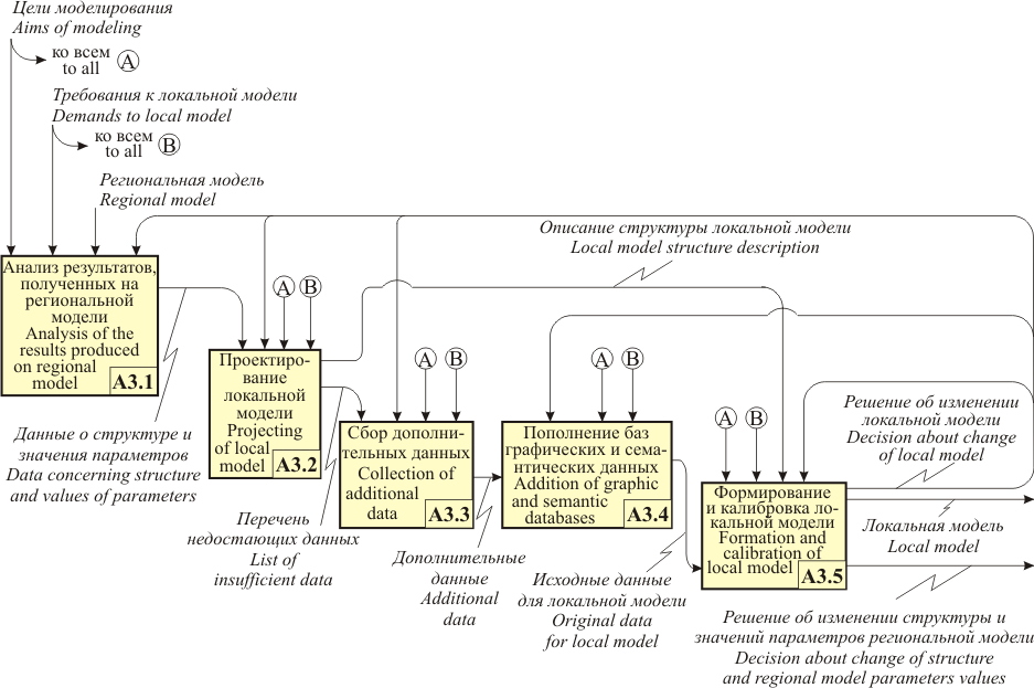
Local model creation
|
Projecting of the local model is made with taking into consideration of the results, produced on the regional model, of aims and tasks of modeling and also of demands for local model. Local model structure is created by way of regional model detailing. The detailing degree is basically depended from aim of modeling from imitated process and from demands for modeling results precision.
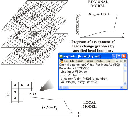
Boundary conditions of the first order (absolute marks of the levels, produced by interpolation of the solution from regional model into boundary block of the local model) are assigning as a rule through outer boundaries of local model. By this it is taken into consideration the influence onto processes imitated of objects, situated within the scope of regional model, but not penetrating onto the local model territory. Boundary conditions are prescribed by use of the special programming means. |
Local model boundaries in section are assigned with taking into consideration of structural elements boundaries. Local model in section can include all the layers or bodies, entering into regional model, or include their part.
Local model type is in a considerable degree defined by the modeling aims, and is also depending from the regional model type. It is necessary to note that during models typology projecting surfaces are used. Surfaces in flat-spaced models are limiting the layers, in three-dimensional models – bodies.
Data concerning regional model structure compose the base of isolated on local models structural elements. Because local model must more precisely represent lithologic structure of object, its structure can be considerably distinguished from the structure of the corresponding area of the regional model. It is necessary during construction of the model to receive the equality of balance components of ground waters flow as for local model boundaries calculated on the regional and local models. If the models are layered then in order to guarantee the execution of this criterion can be made only under equality of water conductivity of every layer of model to total to water conductivity of the layers composing local model. It is necessary note that it is not possible to produce this with absolute precision.
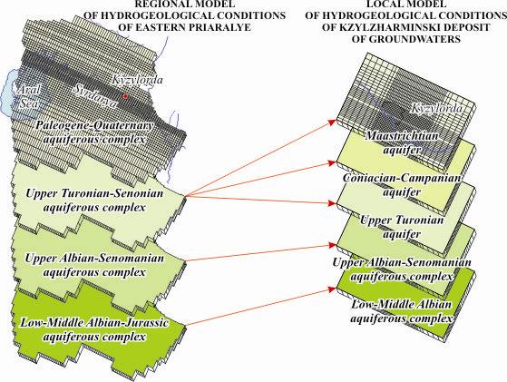
Regional model layers correlation schematic of Eastern Priaralye and that of local model of Kyzylzharminski deposit of groundwaters
|
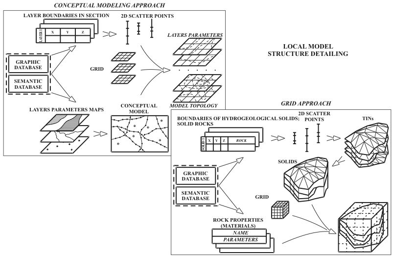
There are existing two basic methods of structural elements detailing for regional model. The first one presupposes transformation of data concerning model topology into so called sets of point data (Scatter Point), and then construction on their base of local model elements. If the regional model consists from layers, then under automated generation of local model topology the layers can be divided by vertical direction for parts in such a way that certain quantity of layers of local model will correspond to each layer of the regional model.
The second method foresees bodies formation on the base of information taken from detailed hydrogeological sections. Boundaries of the structural elements of regional model must be plotted. During sections construction it is used not only information as for wells, but also the large volume of oblique information. Therefore data concerning lithologic structure can be taken both from wells, and from additional points on section. All sections must be constructed in one system of coordinates for their automatic processing. Besides this sections lines must be plotted on the map within the coordinates system which is used by modeling system. |
The first method connects considerably rigidly the topology of local and regional models. During utilization of the second method, information concerning structural elements position of regional model is taken into consideration obliquely, together with other data, represented on the sections. The complex of the special instrumental means has been elaborated for the bodies construction process automation on the base of the detailed hydrogeological sections.
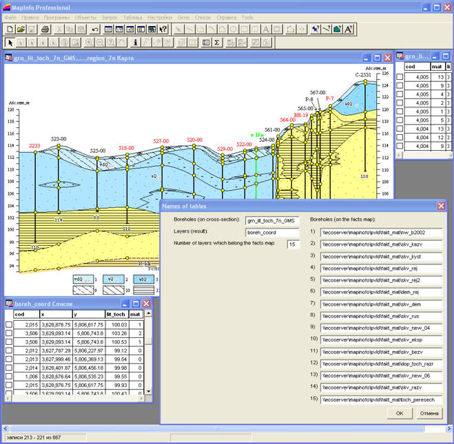
Selection of information from detailed hydrogeological sections |
|
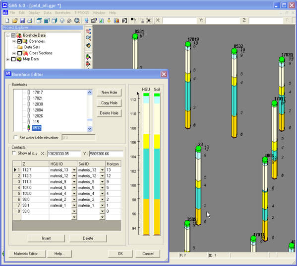
Creation in the GMS 6.0 system of wells coverage |
It is also possible the approach including elements of the both methods. For example, it is possible after construction of the bodies to change three-dimensional structure of the model into layered structure. Use of such a methodical approach, from one side gives the possibility to calculate precisely enough the peculiarities of hydrogeological object structure. And from other side allows to use traditional form of original data presentation in the form of maps and sections.
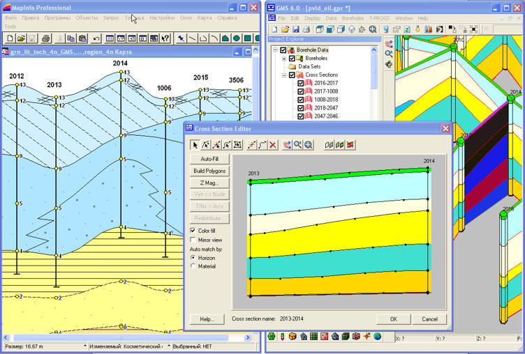
Hydrogeological sections construction |
|
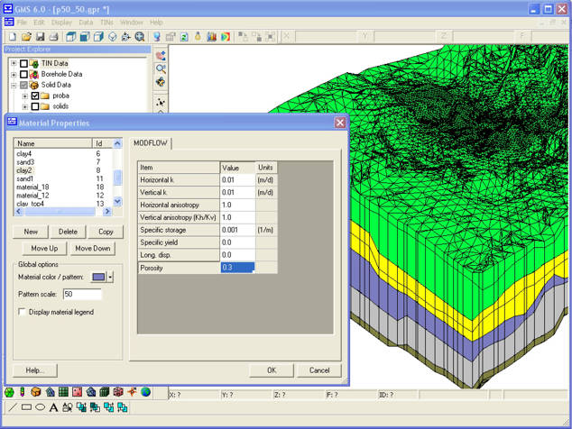
Materials assignment for three-dimensional bodies, |
Additional data collection can be demanded during process of the local model projecting. New information is used for supplement of graphic and semantic data bases.
At the stage of formation and calibration of local model it is foreseen the formation of the sets of initial data; construction of the conceptual schematic of local model; approximation in space and time; generation of the filtrational schematic; calibration of the local model.
Results of the solution received on the regional model and also those collected on it the values of hydrogeological parameters are usually used as original data for local model. If the structure of local model has experienced the considerable changes in comparison with the regional model structure, it is adopted the solution about collection of the additional data, necessary for construction of the maps of parameters. Values of parameters are made more precise and in case of necessity are recalculated.
Export of hydrodynamic task solution
Conceptual schematic of local model is created on the base of the conceptual schematic of regional model. It can contain additional data about natural and technogenic objects with which the attributive information is bound.
Type of the model defines in considerable degree the presentations form of original information. Parameters maps for every layer are forming for models having layered structure. If the local model is the three-dimensional one, then to each body is assigned the definite material with which the set of the fixed values of parameters is bound.
Totally, technical procedure of local model formation in many cases corresponds with regional model formation procedure. The basic difference consists in the necessity of assigning of the specific conditions as for local model boundaries. It is necessary to note that as outer boundaries appear not only the model boundaries in plan. If local model modeling region does not include in section all the layers of the regional model, then the necessity appears to define condition as for bottom of its lower layer. Boundary conditions assignment is very laborious procedure. Methods developed foresee the automatic assignment of boundary conditions with the help of specially developed programming means.
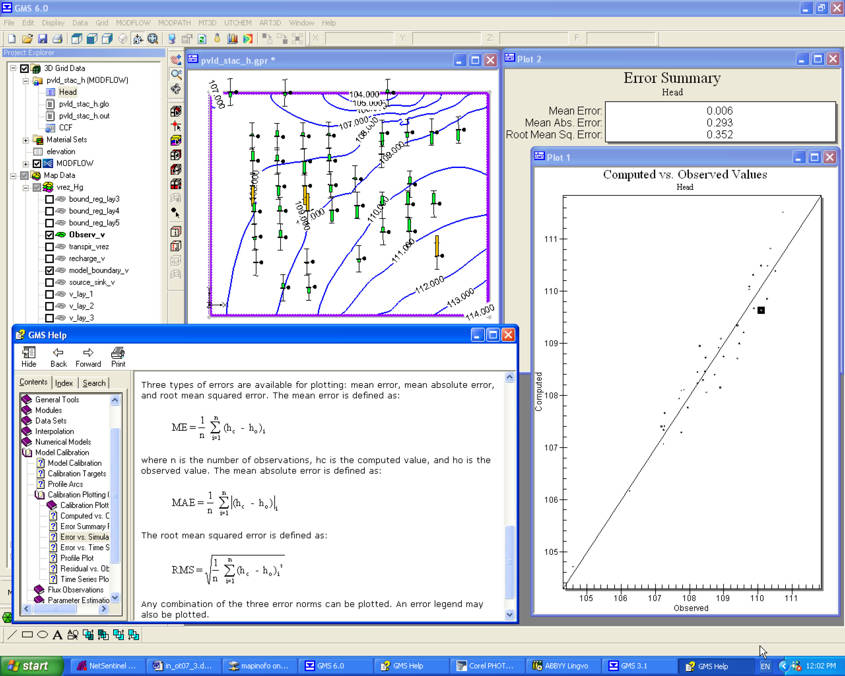
Local model calibration procedure is basically analogous with the regional model calibration process. But its execution presupposes also the utilization of a series of additional demands. Among them correspondence of levels, assigned as for outer boundaries of the first order of local model levels, with the levels, calculated on regional model. It is also of importance coincidence as for boundaries of local model of balance components of the ground water flow, calculated on regional and local model. Another condition is equality of water conductivity of regional model layer with total water conductivity of local model layers. Methods developed foresees the automated calculation of balance components of ground waters flow.
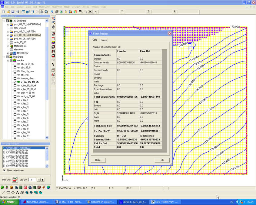
Balance components calculation of for local model boundary
The local model can imitate any additional processes in contrast to regional model. It is necessary in this case an additional step of calibration, connected with its reproduction.
Local model calibration
If at the local model calibration process failed to reach the necessary precision or did not maintained the indicated above criteria of correspondence of local model with regional one, then it is possible to take decisions about regional model structure change and also of the hydrogeological conditions schematization principles. In this case the whole process of model system creation, is repeated.
Result of prognostic task solution |
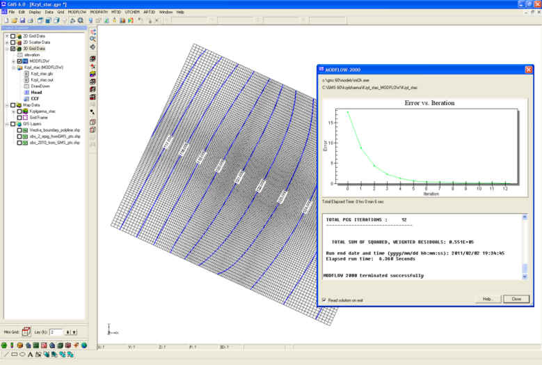
Solution of the prognostic tasks is possible only on the calibrated system. The solution is executed with the use of GMS 6.0 modeling system means. Required values of hydrogeological parameters – absolute marks of ground waters levels for different moments of time of levels lowering, of ground waters levels bedding depths, of concentration of component soluted in water, of temperature and so on – are calculated. Besides this it is executed the calculation of balance components of ground waters flow, and also the calculation of mass balance, and that of heat. |
Modeling results registration
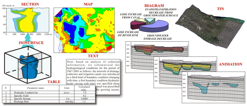
As for results of modeling in automated regime, special maps, sections, graphics of required parameters change, 3D – diagrams, are prepared. Results of the change are written into graphic data base. There are used for their registration the geoinformational systems, graphic editors, special programs for data visualization.
 |
|
 |
|||||||||
Previous |
Next |