ILI-BALKHASH REGION
EASTERN PRIARALYE
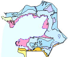
CASPIAN SEA COAST
During last years water problems connected basically with surface waters resources decrease were considerably aggravated in Kazakhstan.
The main reason ¢ decrease of discharge from neighboring states of transboundary rivers of Irtysh, Ile, Syrdarya, Ishim, Tobol, Ural, Talas, Shu.
As the basic users of water are agriculture, industry and civil engineering. In is possible to decrease deficiency of water resources at the expense
of water consumption lowering and also at the expense of more wide utilization of groundwaters.
It is necessary for this to solve the problems of water and land resources utilization optimization, estimation of groundwaters estimation and minimization
of negative influence of ground- and surface-waters onto engineering objects, etc.
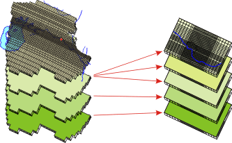
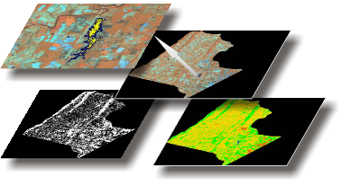
Mathematical geoinformational modeling with use the methods of remote sensing is an effective instrument of these tasks solution.
There are published on this site descriptions of natural conditions of Ile-Balkhash region, Eastern Priaralye and shore, are considered some of the
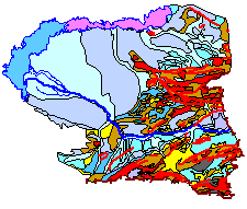
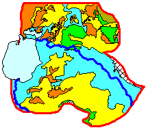
problems of these regions, results of investigations executed, methods and technology of their execution, are given the conclusions and recommendations. There are given the results of mathematical modeling of hydrogeological conditions of Kyzylzharminski deposit of ground waters of Syrdarynski artesian basin for water supply of the city of Kyzylorda. It is given the estimation of negative influence of Akdalinski irrigational massif of Ili-Balkhash basin onto environment with application of GIS and methods of remote sensing.
The works are executed by the Institute of hydrogeology and geoecology of the Ministry of education and science of the Republic of Kazakhstan in the year 2011 as of the project 565201150004 KZH "National informational network improvement as for water problems of Kazakhstan" as of the Program of Participation financed by UNESCO.
These investigations are the logic continuation of the projects 27212604 KZH ōSupport and improvement of the national informational network in Kazakhstan as of the water resources of Priaralye and other regions with strained water balanceö, 00KZ11102 ōSimulation of water resources of Aral sea basin for the provision of population with quality potable waterö, 18314208 KZH ōEstablishment and development of the National Centre in water resources control in Aral regionö,
ECONET, and also that of ōWater vision of Aral sea basin for the year 2025ö.