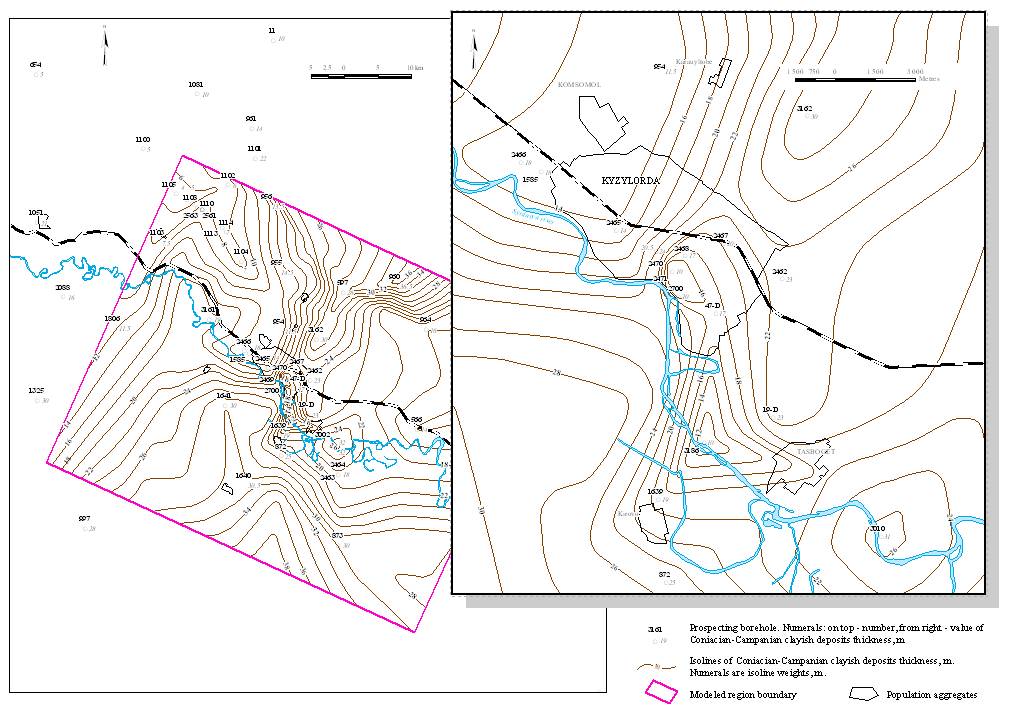
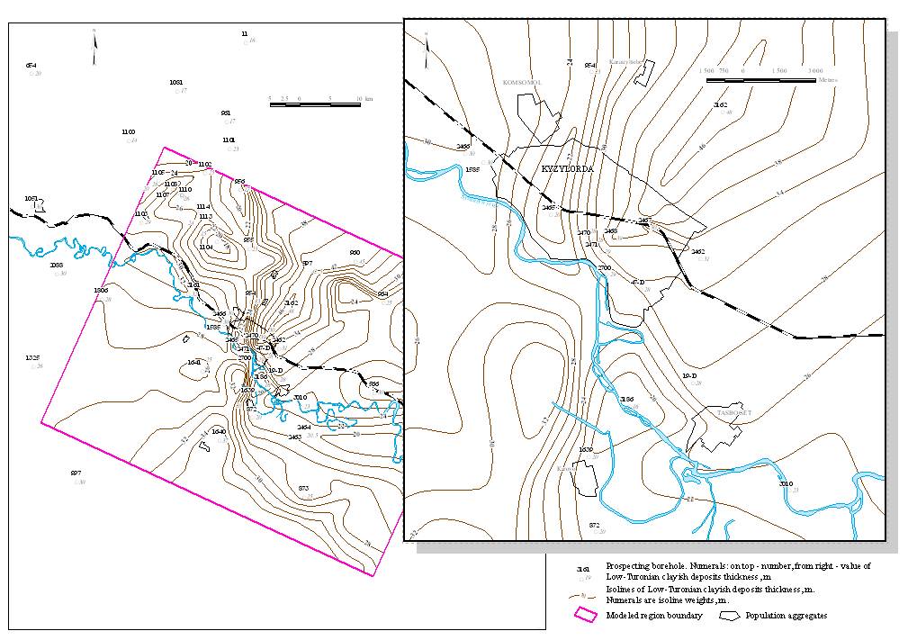
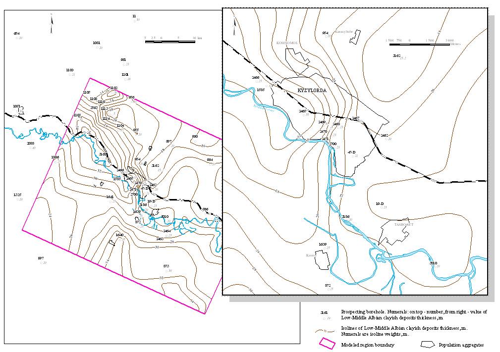
Preparation of initial data for modeling includes the preparation and digitalization of maps with actual material, of absolute marks of bottom (roof) isolated on the model of layers of thickness maps of dividing layers of hydroisopieze maps, of groundwaters mineralization maps. ArcGIS and MapInfo were used for this aim. Numeric models of maps were transformed into special formats of data, which then were calculated by GMS modeling system.
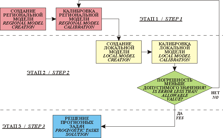
Basic steps of modeling
Map of Coniacian-Campanian clayish depositions thickness of Kyzylzharminski deposit of groundwaters
Map of Low-Turonian clayish depositions thickness of Kyzylzharminski deposit of groundwaters
Map of Low-Middle Albian clayish depositions thickness of Kyzylzharminski deposit of groundwaters
 |
|
 |
|||||||||
Previous |
Next |