|
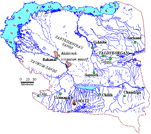
Map of hydrographic network of Southern Pribalkhashye
Ile – the most large water artery of Southern Pribalkhashye. It begins in Central Tien Shan and after outflow from Kapchagai canyon it carry its waters through desert part of Pribalkhashski plain to the regional bate of discharge - lake Balkhash. As the most large tributaries of the river Ile are left bank rivers: Charyn, Turgen, Issyk, Talgar, Kaskelen, Kurty and right bank ones: Khorgos, Usek, Borockhudzier, which inconsiderably increase the discharge of the river Ile because of large losses for filtration and irrigation. Its bed in lower course of the river is rich with oxbow-lakes and islets. At river outlet into lake it forms delta, which is divided info three systems of brooks: Topar, Ile and Zhideli. Alimentation of the river Ile-snowy-glacial and phreatic, with spring- summer high water. Regime of discharge and level of the river Ile depends from amount of draft from Kapchagai storage. The water is fresh, mineralization is 0,2-0,6 g/l with sodium sulphate composition.
Lake of Balkhash is the main basis of territorial waters discharge. Lake of Balkhash is situated in depression: in its western part waters are fresh with mineralization up to 1 g/l, and in castern one- subsaline and salty, mineralization of them does not surpass 3 g/l. Lake area is equal to 19300 km2, length - 605 km, and width changes from 4 to 74 km. Mean depth - 9m, maximal one - 26,5 m. As the basic element of incoming part of aqueous and salted lake balance is river discharge.
 |
|
 |
|||||||||
Previous |
Next |