The Kazakhstan, the greater part of which is situated at arid zone, undergoes the sharp deficiency of quality potable water. Surface waters sources are often polluted, and extremely irregulary situated on the territory of Kazakhstan. Especially sharp the problem of water supply for population exists in Kyzylordinskaya,Akmolinskaya, Atyrauskaya, Mangystauskaya and other regions.
Now as the only reliable source of potable water supply are ground waters. The considerable part of the prospected deposits is confined to the artesian basins. They include, together with the territory of Kazakhstan, the territories of the adjoined states. Problem of water distribution can appear under intensive exploitation of the deposits, confined to the artesian basins.
|
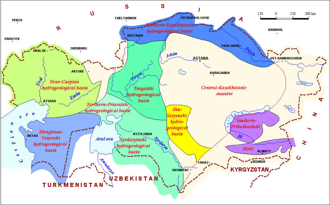
Structural-hydrogeological regions of Kazakhstan
(Compiled in accordance with the monograph of Veselov V.V., Sydykov Zh.S. Hydrogeology of Kazakhstan. – Almaty, 2004. 484 pp.)
Mathematical modeling methods of ground waters resources estimation, of hydrogeological conditions change forecasting under influence of their exploitation, of estimation of the influence region of the exploited now and projected water intakes, are the most precise ones.
 |
||
Next |
| [Home] | [Contents] | [Links] | [Autors] |