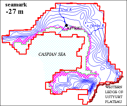
The rise of the water level in the Caspian Sea give essential losses for economy. The industrial objects, pastures are sunk. Irrigating massives are put out of action. Objects of the oil and gas complex become source of pollution for coastal zone. It is potential threat to biological resources of the sea. The rise of the water level in the Caspian Sea cause the rise of the subsoil water level. The swamping of the territories, drowning a little of the foundations of dwelling and industrial objects, lines of electricity transmission, pipe-lines are consequences of this. In accordance with data of Scientific and Research Institute for Monitoring of Environment of the Republic Kazakhstan prognostic state of the water level in the Caspian Sea may reach the absolute elevation from –26 to –22m. The modeling of the hydrogeological conditions of the coast was executed for an estimation of influence of the current level rise of the Caspian Sea on state of surface of the subsoil waters. System with 3 levels of the interconnected models that’s structure is given on figure was created.
|
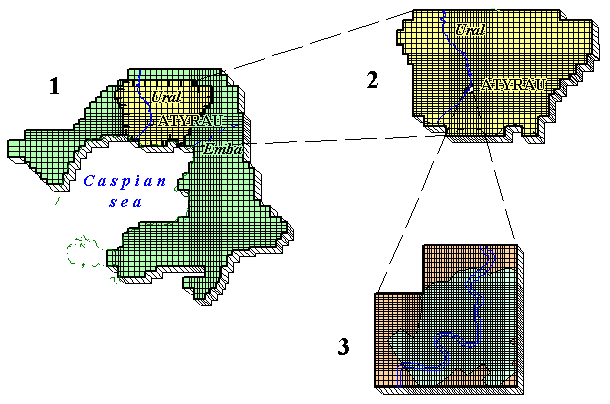
Models system of the Kazakhstan part of the coast of the Caspian Sea
It consist from regional model of the Kazakhstan part of the coast of the Caspian Sea (scale 1:500 000), model of the Ural river lower reaches (scale 1:200 000) and model of the subsurface waters for Atyrau city (scale 1:10000).
Restoration of hydrogeological conditions for the year 1977 has been made by the way of solution of reverse stationary task on each model. Values of areal feeding and discharge, flows as of outer boundaries of the I-st and II-nd order, filtrational properties of water-bearing rocks have been adjusted at the process of the solution. Groundwaters levels marks agreement, measured as of boreholes and produced on the models has been as the criterium of adequacy of the models with the real hydrogeological conditions. The precision of the solution given equal: for the regional model - 2m, for the model of the 2-nd order - 1m, for the model of the 3-nd order - 0.5m. Results of the solution are given on the Figure.
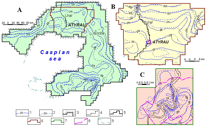 |
Integrated maps of hydroisohypses (result of the solution of the reserve stationary task):
A - Kazakhstanic part of Caspian sea shore, B - downstreams of the Ural river, C - region of the Atyrau city
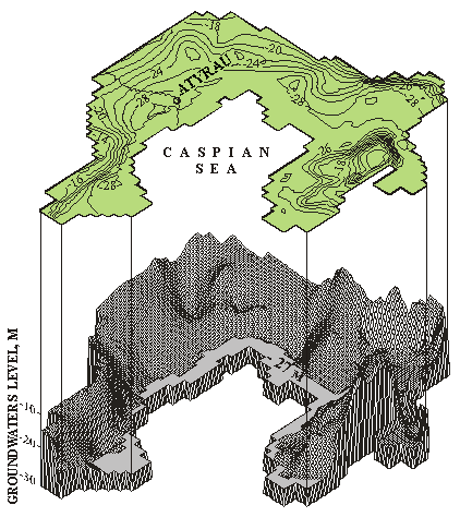
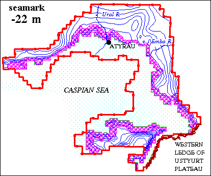
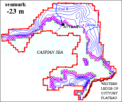
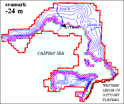
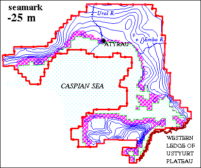
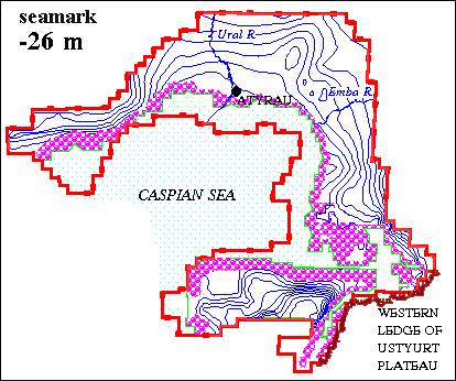
6 variants of the predictions for sea level elevations –27, -26, -25, -24, -23, -22 m was calculated on the regional model. Prediction was executed on the term for 30 years. It was assumed that the rise on the Caspian Sea goes on instantaneously. Compiled prognostic maps of the contour of water tables was given on Fig. Also the regions of the head of subsurface waters in coastal zone was given on the maps.
Forecasted level surface of groundwaters
of Kazakhstanic part of Caspian sea shore as of the state
for the year 2028 under absolute mark of water level in sea -27 m
 |
|
Prediction maps of the contour of water table of the Kazakhstan part
of the coast of the Caspian Sea on the period to 2028
(compiled V.V.Veselov, V.Yu.Panichkin)
|
||
|
|
|
|
| |
|
|
|
| Legend
1 - contour of water table in 2028, 2 - contour of the indication of the border terms of I kind, 3 - contour of the indication of the border terms of II kind, 4 - net approximation of the
modeled region (numbers - numbers of the lines and columns, 5 - zone of the head of water from the side of the Caspias Sea (size of the head to 0.3 - 0.5 m, 6 - coastal line (note of he sea is
indicated on Fig). |
||
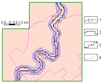 |
Map of forecasted rise of groundwaters level of Atyrau city region for the year 2010
in relation to the yaer 1993 (with Caspian sea water level mark of -26.5 m)
In such a way, retaining phenomenons were caused in subsoil waters in city firstly by self-drowning a little processes at the cost of leakage from water-supply and sewer net of the city watering of green plantings and filtration from the irrigation canals.
In conclusion it is necessary point out the following.
At a later time it is appropriate creation of the detailed models of some parts of the coastal territory that have important role for economy. It is necessary for more authentic estimation and forecasting of the possible rise of the background water level in the Caspian Sea, and also surge phenomenons on subsurface waters.
 |
|
|||||||||
Previous |